Thursday, June 30, 2011

Swiftwater RV Park, White Bird, ID

Today's Photo - A Floating Generator on a River


I woke up this morning with the patter of rain on the roof. Luckily, it stopped by the time I finished breakfast. I did get my shower & laundry done, however it was at the Pizza place in Stanley yesterday afternoon. Although they did fix the water problem at Elk Mountain RV Resort, they wouldn't have hot water until morning & I wanted to get a somewhat early start.

The drive to White Bird, ID on ID 21, ID 55, and US 95 was wonderful. Almost the entire was was driving along pretty mountain streams, filled to capacity (or more) with spring runoff. The photo above shows an interesting power generator. It is a funnel on a set of pontoons that feeds the river water through a turbine & generator. An interesting idea - I have no idea how much power it generates, but it would be useful for locations on fast moving streams. If you look closely, you can see they also had a solar panel...

I'm in Swiftwater RV Park, site 13, a well kept and very pleasant campground on the shore of the Salmon River. It is nice to see the "other" Salmon River. it is bigger than ours in Oswego with about 20 times the amount of flow, and at present, is full of rafters.


I lost an hour - I'm back in the Pacific time zone I have a steak & corn on the cob to cook for dinner - I probably should think about cooking.

Till Tomorrow -

Wednesday, June 29, 2011

Stanley, ID

Today's Photo - The Stars at Craters of the Moon


I tried again for some nighttime star photos. The short exposure (well, 15 seconds) came out OK, however I also tried a star trail, leaving the shutter open for around an hour. Only problem is a few campsites over from mine they decided to use their flashlights at 12:00AM, and the image was ruined. I'll try again if I get to a dark location.

I continued west from Craters of the Moon to ID 75 & ID 21, stopping for the night just outside of Stanley at the Elk Mountain RV Resort. Not quite a resort, but the price is right - $27.00 for full hookups. There is one problem - I chose the campground because AAA listed it as having showers & a laundry. Well, they do, but they also have a water problem, and as of 3:00, there is neither and no bathrooms. Hope they get things working soon.

Other than that I'm spending the rest of the day reading & since I have a pretty good internet connection, catching up on some of the RV sites I follow.

Until Tomorrow -

Tuesday, June 28, 2011

Craters of the Moon 2 & The EBR-1, ID

Today's Photo A Lava Field at the Craters of the Moon National Monument, ID


I set up the camera to take a series of 15 second exposures starting at midnight. I checked them out a little after 12:30 & I didn't get quite what I wanted, but here is one of them. I'll try some more tonight as well as shooting a star trail, a long exposure that makes circles out of the stars because of the earth's rotation.


Today's plan was to drive through Arco and visit the EBR-1, the world's first power plant that produced usable electricity. After that I'd return to Arco, do laundry, get a haircut, and pick up something for dinner.

I figured I should check out the EBR-1 since I live in a town (Oswego, NY) that has three nuclear power plants as well as a large (over 2 Gigawatt) formally coal, switched to oil, then switched to natural gas power plant - which, for some reason only runs a few hours per year when the temperature is under -10°F, as well as a couple of hydro plants on the Oswego section of the Erie Canal.

The EBR-1 started producing electricity in 1951, and powered the town of Arco, the first city to have "Atomic" power. I've toured one of out local "Nuke" plants (long before 911 - you can't get near them now) and it is interesting to see the similarities & differences. I added a group of photos at today's Lakeshore Images Journal Page. I love the image of the turbine & generator with the names of the persons at the plant when it was first started.

Outside the EBR-1 building are two huge nuclear aircraft engine prototypes. I never knew it, but in the mid 1950's there was a plan to build a nuclear powered bomber that was capable of staying in the air for over a week. For a number of reasons it was never built, but the prototype engines were built & tested.


Although not the most important National Historic Landmark of the trip, it is definitely worth a stop if you are heading towards Craters.

As to doing laundry, well, the only laundromat in Arco (or within miles) is closed. I had to go to Moore, about 7 miles north of Arco to find a place that takes drop in haircuts, but had a good time talking with the barber - the first time a man has cut my hair since I was in high school.

Till next time -

Monday, June 27, 2011

Craters of the Moon National Monument, ID

Today's Photo - The Tetons, WY


As the title says, I'm at the Craters of the Moon, Site 38. If you have never been here, as its name implies, it is a strange place. All the campsites are carved out of black pumice, with rocks the size of basketballs that you can hold in one hand. Most of the sites are fairly small, although a few are large enough for a 36' Class A or large 5th wheel. There is water available (although no hookups, and no dump station). I'm in the back section which is only for small trailers or tents. Very quiet, and I hope it will be dark enough for some star pictures tonight. The skies are clear...

On the way out of the Tetons I made one last stop at Mormon Row - better lighting, but not quite what I was looking for. Oh well, maybe next time...

I'm not sure how long I'll stay here - I do want to see some of the caves, the cinder mounds, etc here in the park so it will probably be two days unless I get tired of not having electricity (or worst, at least for others, a shower!)

Till Next Time -

Saturday, June 25, 2011

The Grand Tetons & Yellowstone, WY, Day 2


Today's Photo - A Mormon Barn, The Grand Tetons National Park, WY


I'm posting today's journal from the Jackson Albertsons parking lot. A good cell signal as well as a open local WiFi. An early morning - outside temperature was 37°F while it was 48 inside the trailer until I turned on the heat. A quick breakfast & it was off to see the Tetons. Although I made most of the stops along the way, my main goal for the day was to hike to Hidden Falls. It is a 3.5 mile hike mostly around Jenny Lake. A big advantage (that I took) is there is a $7.00 boat ride back that saves 3 miles of walking.

The falls is actually a cascade, and it is running very strong with the spring snow melt. Strong enough that only one of the three bridges across the stream are usable.

After the boat ride back I went to Mormon Row to photograph some of the barns that Ansel Adams made famous. I hope to get back tomorrow morning - the afternoon light was quite harsh & unforgiving, but I'm including a couple of images anyway. Check the rest of the day's photos at Today's Journal at Lakeshore Images.

After that it was off to Albertsons for dinner supplies and a few new books. I'm just about out, but my favorite authors have come through with new summer books.

Till Tomorrow!

The Grand Tetons & Yellowstone National Parks, WY

Old Faithful, Yellowstone National Park, WY


I'm not at all sure when the next few pages will get posted - I don't have any cell signal or WiFi here at site 63 at the Flagg RV Resort. Not sure why they call it a resort other than the prices they charge - $64.00 per night (although that is about the price for sites in the area that are not actually part of the park system). Although I have seen lots of complaints about the Flagg RV Resort on line, I suspect the high price generates most of them. I have stayed in far worse (and, of course, much better). The sites are on dirt, but nicely shaded, only 20 amps available, but clean bathrooms with large showers. In any case, I'm here for a couple of days to check out the Tetons & Yellowstone.

Last night at the KOA was interesting - we had a hailstorm that dropped 1/2"hailstones - sounded great on the trailer!

After setting up the trailer at Flaggs I headed off to Yellowstone. I got as far as Old Faithful before I decided it was time to had back to the campground for dinner. I did get a photo of Old Faithful spouting off, however it sure seems pretty lame compared to the last time I was here. In any case, I included a photo.

Till Tomorrow -

Thursday, June 23, 2011

Montpelier Creek KOA

Today's Photo - Ricks Spring Along US 89, Idaho


Another quiet day with an early stop. By the way, although the Cherry Hill Campground in Kaysville was primarily a water park, and still a bit too refined for me, my site (21) was actually a really nice location. It was on grass, and had plenty of room on both sides. Much of the rest of the campground had sites barely wide enough for people to open their slides, while mine wasn't all that deep, there was plenty of room. I guess that is another advantage of a small trailer!

Today I headed up US 89. Although a 4 lane expressway for some of the way, once past Mantua, UT it changed to a 2 lane road, and soon started climbing through the Wasatch-Cache mountains with the usually twists & turns. The stream along the road was well over its banks in many areas. I stopped to take a photo at Ricks Spring along side US 89. One of the persons there said they have never seen it flowing that strong - it was over the walkway.

After that I continued over the pass at Bear lake Summit, then on into Idaho. I stopped for the day at the Montpelier KOA in Montpelier, ID, the first KOA of the trip. As I've mentioned in other trip journals, KOAs remind me of McDonalds - you always know what you are going to get, but there are no surprises. I didn't have a lot of choices - both the AAA guide & my GPS didn't show many other campgrounds in the area. I'm is site 28, a very nice location with shade & a stream running by.

Till Tomorrow!

Wednesday, June 22, 2011

Another Day In Salt Lake City

Today's Photo - A lilly From The past


Not much interesting going on today.  I now have a clean sensor on the Nikon D700, and my RAV4 has all new fluids, including transmissions.  Although it was a little early for the transmission fluid change, towing, particularly in hot weather & 8-20% grades is a lot of work for the poor thing.

Other than that, I spent the day reading, thinking about where I'm going tomorrow  - the current thought is to head up US 89 until I either hit the Tetons, or stop sooner if I get tired of driving.  I'd like to spend some time in the Tetons - a beautiful park.

Till Tomorrow!

Tuesday, June 21, 2011

Salt Lake City, UT

Today's (Actually Yesterday's) Photo - Along the Panorama Trail, Kodachrome Basin State Park, UT


As you have figured by now, things change.  Last night after returning & processing a group of images from an evening walk through Kodachrome Basin State Park I finally reached the point where the dust & shutter oil droplets on the sensor in the D700 wouldn't go away.  Many of the parks I've been in lately are dusty, and, although I have tried to make as few lens changes as possible, even the car is filled with fine red "Moab Sand"(red dust).

I tried cleaning the sensor, but with little improvement.  I'm surprised that the D700 with a full frame sensor is more difficult to clean than the smaller sensor in my D200 or D300.  In any case, it was time to find a real camera store/repair location to get a good cleaning.  The closest I could find was in Salt Lake City.  It is in the general direction I'm heading although my plan was to cut across US 50 to US 93 & head north on that.  Now I will probably take I80 to US 93 on Thursday.  Since I have to stay two days to get the camera cleaned, I'll also get an oil change & transmission check at the local Toyota dealer.

So, tonight's campground photo was taken with a lowly Coolpix 995.  Actually, it isn't a bad camera.  Only 3.34 megapixels, but the output will cover any web page & I have managed to print a decent 16" X 20" from it (as long as you don't get too close).


Speaking if campgrounds, I an staying in the Cherry Hill Campground in Kaysville, UT, site 21.  It is an interesting place.  For me the only virtue is it is close to Salt Lake City - much too refined for me.  It is actually a water park with a campground attached.  Still, a nice place for a couple of days.

Till Tomorrow!

Monday, June 20, 2011

UT State Route 12

Today's Photo - Grosvenor Arch on the Cottonwood Road, GSENM.


The plan for today was to drive UT 12. The day started out cold @ 44°F this morning, but warmed quickly. I took a couple of photos along UT 12, one of the most scenic in Utah, but they don't do the road justice. With the expansive views, you have to be there, particularly along the section of road that travels a ridge. There is a 100'+ drop on either side, little or no shoulders and, of course, no guard rails. After driving some of the dirt backroads I've been on, it didn't bother me, but the people on the campsite next to me yesterday were from Québec, and they were not happy with it!


Speaking (well, typing) of dirt roads, I drove another section of Cottonwood Road, this time from the top south. I wanted to see Grosvenor Arch which is about 18 miles south of Kodachrome Park. I've only missed about a 10 mile section of the road between Kodachrome & US 89 near Page, AZ, and according to the volunteer at the GSENM Visitor's Center (the Grand Staircase-Escalante National Monument) the section between Kodachrome & the arch is the worst part of the road. I probably could have pulled the trailer over the length of it, however I would have to put half the stuff in the cabinets back - lots of washboard & bumps.

After returning from the arch I went back to Kodachrome (which is on Cottonwood Road) for a few more photos of sections I didn't get to when I stopped there with Don & Anne on June 10th.

I suspect today's post will be late - my connection here at Bryce Pioneer Village is Verizon only @ 24K, or half of a normal dial up connection. I may drive the 6 miles to Ruby's Inn for a connection.

Sunday, June 19, 2011

Capitol Reef National Park, UT, Day 2

Today's Photo -  A Mormon  One Room Schoolhouse,  Capitol Reef National Park, UT


Well, today is different. It's 4:00, and has been the first really bad day of the trip. It rained off and on lightly last night, and was around 56°F this morning when I got up around 8:00. It has been downhill since. The wind is rocking the trailer, the temperature is down to 47° and falling, and, although it sometimes clears just enough to think it is worth heading out, it starts to rain again as you open the door!

I guess I can't complain - for most of the trip I have had pretty good weather, at least for the seasons I have been traveling in. I spent most of the day catching up on reading some of my RV web pages, and adding some of the trip photos to my screensaver.

Unless the weather changes, there won't be any new photos other than a site picture added at today's Lakeshore Images Trip Page - The one above is from yesterday.

Well, I got lucky. Around 5:45 the sun came out. I jumped in the car & drove to the Hickman Bridge parking lot. There is a great view of Pectol's Pyramid from the trail to Navajo Knobs. This is a 9 mile round trip (I didn't do the whole trail!) but along the way there is a good combination of the black andesite boulders & the view of the pyramid across the Fremont River. As I said, I was lucky. By the time I got back to my car the clouds rolled in.


Till Tomorrow!

Saturday, June 18, 2011

Capitol Reef National Park, UT

Today's Photo - Hickman Bridge, Capitol Reef National Park, UT


I drove up to the Goblin Valley parking lot to post the rest of yesterday's photos, and while waiting took a few morning images.

After that I headed for Torrey & Capitol Reef National Park. I dropped the trailer off at Thousand Lakes RV Park (not a lake in sight) and am in site 9. A nice place. The site is a back in, but deep enough for both the trailer & car. The bathrooms are clean, the showers big enough, and not too far from the site.

After that I headed back to the park, took the scenic drive, a couple of side roads, and some of the stops along UT 24. I'm here for two days, so I'll hit the rest tomorrow. Lots of different colored rock, the Fremont River, and some early Mormon settlements are in the park. It doesn't look like any of the fruit trees are ripe - they let you pick & eat them when they are.

I picked up a steak, broccoli & cauliflower, and used my second to last bag of Vigo Yellow Rice for dinner. Now it's time to sit back & relax! More photos at today's 2011 Trip Page at Lakeshoreimages.

Friday, June 17, 2011

Goblin Valley State Park, UT

Today's Photo - Some of the Goblins at Goblin Valley State Park, UT


I've seen photographs from Goblin Valley State Park on the internet & have always wanted to see the place for myself, so here I am. Not too far from Green River, but I'm basically killing time waiting for the Narrows to open at Zion. What a way to kill time. This place if fascinating! You feel like you have been dropped onto another planet. There is an overlook at the end of the road into the park, however to get the real feel for the place you have to walk down into the valley. It is an easy walk, but I suggest taking water - you will likely wander around from place to place until you have done more miles than on a normal trail. You are free to wander anywhere on the valley floor, and the formations are different everywhere you look.

The campground is out of water, at least under pressure, however since I have my own, they gave me a site. It won't be open until 2:00, so I'm checking out the rest of the park. I suspect the formations will be even more interesting during the "magic hour" just before sunset & after sunrise so staying in the park is just what I wanted to do.

Well, the good news is the water is back on at the campground, so there will be showers tonight.  The bad news is tonight's "magic hour" lighting isn't even 1 minute long - the clouds got even heavier, a bit of rain, and no sun.  It's too bad - there is almost a full moon tonight which would look interesting over the valley.  I'll go looking for it, but am not hopeful!  As usual, more photos at Lakeshore Images Trip Page.

Some days you just get lucky. After dinner I was reading a book when a ray of sunlight poked over my shoulder. I grabbed my camera & drove back to the valley part of Goblins (it is about a mile from the campground). The light was good, I even managed to catch a rainbow. I'm going to start a page just for the park (Goblin Valley State Park) but here is one of the evening photos:


Till tomorrow -

Thursday, June 16, 2011

Green River, UT

Today's Photo (Actually, another one from yesterday - I didn't take any today)
Buck Canyon Overlook, Canyonlands National Park, UT


Hard to believe I've been on this trip for 2 months.

We had a wind storm last night that was the equal of the Valley of Fire storm. I can't tell you how much the first blast rocked the trailer - I was in the campground shower covered with soap when the power went out. The water in the campground is supplied by a pump - it was the fastest rinse I've ever tried, and I almost made it!

This morning I started out doing laundry in Moab. Although the campground had a laundromat, it was very small, and was always full. The one I stopped at in Moab had a commercial washer which made quick work of my pile of stuff. After that it was off to the car wash to get rid of the Moab Sand (fine enough that I'd call it dust) that covered everything, inside & out. I even managed to wash part of the trailer.

I followed I15 for about 25 miles, getting off in Green River. I'm at the Shady Acres Campground, Site 26. The campground is actually shady - I'm under a tree. The showers are not too far away, are clean & have large stalls. It was 95°F when I pulled in, however another rain & wind storm came up just after I arrived, and the temperature is down to 72°F right now. This storm actually included a fair amount of rain - there are puddles all over the campground, and the RAV4 & trailer are just as dirty as they were yesterday. Oh well...

Till Tomorrow -

Wednesday, June 15, 2011

Canyonlands National Park, Island in the Sky, UT

Today's Photo - Mesa Arch, Canyonlands National Park, UT During Sunrise


I did manage to get up at 4:15AM, and managed (without coffee!) to make it to Mesa Arch in the Canyonlands by 5:30AM. Much to my surprise, there were already 5-6 photographers there when I arrived. Luckly, there was still space for me, although a bit to the left of where I wanted to shoot.

The photograph of the canyons through Mesa Arch is a famous one, at least for Canyonlands. At first, prior to the sun hitting the arch it doesn't look like much. As the sun rises it hits the underside of the arch, making it look like it is almost on fire. The "Look" only lasts for about 15 minutes, changing all the time. I included a couple of different frames shot over the sunrise at today's Lakeshore Images 2011 Trip Page.

After that I continued through the park for some morning shots, then back to the campground to relax. There are some afternoon photographs I'd like to shoot - I'll go back after lunch & add them to the page this evening.


I took a trip on a road I've wanted to drive since the last visit to Moab - the La Sal Loop. This is a narrow two lane, mostly paved road that gos through the La Sal mountains. Lots of nice views, cows on the road, in fact an actual cattle drive. I came around a corner, and rather than just one or two cows like most of the road, there was a whole herd, complete with cowboys (and cowgirls) on horses, cattle driving dogs, etc going down the road in the same diredtion as me. Ane of the cowboys waved me on, so I threaded my way through 1/4 mile of cows. An interesting experience!

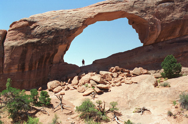
I have come to the conclusion that nature photographers (at least one that I know very well) are nuts. Who else would go on a 3 mile hike on a nonexistent trail on a 95°F day to take a photograph of something that he saw in another photographer's work? I am also completely direction deficient. Ask Don or Anne - I go into a store parking lot or gas station, and the chances are 50-50 that I'll turn the wrong direction coming out. Not the skills necessary for hiking in the middle of Canyonlands. Still, I did want to shoot an image of the False Kiva, which is only well lighted in mid afternoon, so I stopped at the Visitor's Center, talked with a ranger who made a rough map, described the hike, and gave me instructions of what to do & not do at the site. I took my handheld GPS with me to leave markers as I went.

The first mistake was to take the wrong unmarked trail. After an hour hiking over slickrock, following carins I ended up overlooking the Holeman Spring Basin from the top of the cliffs that the False Kiva was under. No way down, so back to the road. I discovered the real non trail, and if I was in my right mind, I'd say "that's nice", but one 3 mile mid afternoon hike is enough. Of course, I didn't, so off I went. Everything worked fine until I reached the cliff face. Although there are plenty of carins marking most of the way, at the face I got lost. Since the part where I was confused was under the cliff ledge, the GPS was useless - no satellite reception.

I ended up doing some scrambling on rocks that should have never been scrambled upon. Finally, I decided to try one more time to find the Kiva. I ended up on the trail back to the road. As I passed a tree I remembered passing before I turned around, and after a short climb, found the Kiva. Of course by then it was far too late in the day so a shadow fell across the Kiva, but I shot it anyway. The hike back just about killed me, but I made it.


Until Later!

Tuesday, June 14, 2011

Arches National Park, UT

Today's Photo - Skyline Arch, Arches National Park, UT


I got a fairly early start this morning & headed into Arches. Visiting Arches is probably the main reason for this trip. In 2004 my wife Carol was feeling bad & we decided after Zion to head home without stopping. I've always wanted to take more photographs of Arches, so here I am!

I used part of the morning as a scouting trip for Delicate Arch. The best time for photographs is late afternoon, so I wanted to choose which lens made the most sense & only take one during the hot afternoon. Looks like the 24-70 wins.

I also did the same for Mesa Arch in Canyonlands. A beautiful photograph is possible at sunrise at the arch. Of course since sunrise is at 5:55AM tomorrow & it takes around an hour to get there from the campground, it means an early day. I'll try! By the way, I really couldn't decide which lens, the 17-35 or the 24-70 worked best at Mesa Arch, but since it is a much shorter hike (and cooler) I'll take both.

I took a few different angles at Balanced Rock because it looks so different depending on where you are on the trail around it. Although you can see the Delicate Arch from a short walk from the road, it takes a telephoto lens (in this case a 200mm) to shoot it & it isn't all that interesting an image. To really shoot it you have to take the trail to the arch itself, a 3 mile hike with a 480' gain in height. Not as bad as Angel's Landing in Zion, but a good climb over slickrock. The heron was at a pond at the trail head for Delicate Arch.

All the other arches are fairly short hikes in from the trail heads. I'm not sure how Don managed to get into Skyline Arch for the photo I took on our 1996 trip, but he did. No one was there today!

Anyway, the rest of today's photos are on my Lakeshore Images Page for today.

Well, I did go back for the late afternoon sun & it was a definite improvement. I also decided to take a new route to the arch (alright, I admit it I somehow lost the trail). I added some photos from the usual location as well as my "new" one to the LakeshoreImages page.  Here is one of them:


Till Tomorrow...

Monday, June 13, 2011

Canyonlands, The Needles, UT

Today's Photo - A tree along the walk to Cave Spring, The Needles section of Canyonlands National Park, UT


Wow, I only had to make a 1/3 of a pot of coffee this morning!  With Don & Anne along we go through two pots (it is a 4 cup coffee maker). I made reservations at Arch View Campground which is about 9 miles north of Moab. Beautiful views in all directions, family style bathrooms, but they put me in a fairly small space - I have to park the RAV4 behind the trailer.  On top of that there is a female mulberry tree next to the site (at least it is on the left side) that drops berries all over the place - they get tracked into the trailer & are tough to clean off the floor.

When I made the reservation the woman on the phone suggested I drive out to the Needles section of Canyonlands on the way rather than make the 75 mile drive from the campground.  I did, and there were many nice rock formations throughout the drive & park.  They are tough to photograph because the appeal is the overall view & that just doesn't fit in the normal frame of the camera.  I did take some panoramas that I'll try to stitch together after I get home. There are more images from Canyonlands on today's Lakeshore Images page, at least as soon as I get it posted.

I have to take a break from the trip report to mention a former student.  Brian Ronan was one of my  students at SUNY Oswego - last night he won a Tony Award for his sound design of The Book of Mormon.  Having one of your students excel is one of the greatest rewards of teaching - I've had many successful students, but Brian is the first to win a Tony.

Back to today - I'm in site 42 for the next 3 days.  The plan is to explore Arches, Canyonlands, and the sights of Moab.

Till Tomorrow!

Sunday, June 12, 2011

Back at Monument Valley

Today's Photo - Agathla Peak along AZ 163.


A short drive today. I have to get use to traveling solo again - Don & Anne are heading south to the Grand Canyon while I'm on my way north to Moab & Arches National Park. Although I could do it in one day, I decided to break the drive in two, and spend a little time getting organized. I'm in Goulding's Monument Valley Campground, Site 17.

Till Tomorrow!

Saturday, June 11, 2011

Antelope Canyon Revisited

Today's Photo - Upper Antelope Canyon, Page, AZ


I went back to Antelope Canyon in with Don & Anne. This trip was a bit different. Although we had fewer photographers in our group, the canyon was much more crowded. We also only had one guide. On the May trip another guide was making a full day tour with two individuals. They joined our tour going through the upper canyon, and having two guides made it much easier to keep the other groups out of our photographs. We still had time to shoot the empty canyon, but it was more rushed than before. 

If you are going to Page just to shoot the canyon, I suggest going early in the year. They are open year round. I put information about the tour company I went with both times on the Antelope Canyon Page.
Like the May 11th page, I also added more Antelope Canyon photos to the Antelope Canyon Webpage.

There was a little excitement on the way back from the canyon - one of another company's pick ups used to take the one hour tour groups to the canyon had a bit of a problem on the way in!

It looks like we are going to spend the rest of the afternoon goofing off & posting this page. 

We did get off our butts & made a run to Walmart for another memory card for Anne's camera (she has discovered movies) dinner, (steak, corn on the cob & salt potatoes). We also stopped to see the Glen Canyon Dam Visitor's Center.

Till Tomorrow!


Page, AZ Revisited

Today's Photo - Anne at Horseshoe Bend, AZ


I'm a little late posting today's (well, yesterday's) update - I was tired & went to sleep instead of posting.  I could blame it on the time zone change, a slow, poor cell connection, but I was just tired!

We took a short detour to Kodachrome State Park, UT, and took the Angel Trail hike, a 1.6 mile round trip that climbed over the parking area, passed a number of interesting trees & rock formations.

After the park it was South on US 89 to Page.  We quickly set up at the Lake Powell-Page campground in site 15, made a quick run to Walmart for stakes strong enough to drive into the gravel, then headed to Horseshoe Bend for some photos.  The skies were much more interesting than the last time I was here.  A storm threatened, producing great clouds (and a bit of lightning, but in the distance).  We stayed until the rain got bad enough that we headed back.  Of course after going 3/4 of a mile in soft sand back to the parking lot the rain stopped & the sun turned gorgeous.  Oh well, maybe next time!

As I said at the beginning, I was tired & went to sleep.  As to the time, well, I WAS WRONG!  There, I admitted it - it was actually an hour earlier than I insisted it was.  We didn't find out for sure until this morning at Walmart.

Tomorrow (actually today) we will do the photo tour of the Upper Antelope Slot Canyon.

Till Then -

Friday, June 10, 2011

Bryce Canyon National Park, UT

Today's Photo - Sunset at Bryce Canyon National Park, UT


Although the original plan was to head to Page, AZ today, we changed out mind and decided to revisit Bryce Canyon. We were last there in 1996. The drive was uneventful & we pulled into Ruby's Inn RV Park & Campground around 1:00. Somehow we mixed up where we stayed on out 1996 trip. We all thought we stayed at Ruby's Inn Campground on that trip, but now figured we were in one of the campgrounds in the park. In any case, this time we are in site 83. A little tight, but the problem solved - the tent moved a little off the site into the trees!

After setting up the trailer & tent we headed into the park. Just as breath taking as last time - looking out over the formations is amazing. It is a problem for photographers. You eye constantly isolates the different structures, but the camera can't. Trying to compose an image out of the mass of formations is difficult.

We drove up the length of the park, stopping at all the viewpoints. After that we went to the "Fast Food" restaurant (Part of the Ruby's organization which runs just about everything just outside the park). Although a bit expensive for fast food, it was hot, good & plentiful. We also did a bit of grocery shopping at the general store (which is fairly limited unless you are buying tourist mementos) dropped them off at the trailer & went back to the park to shoot some sunset photos. Although there wasn't a great sunset, we did get a few that had improved color over the mid afternoon images. If you are interested in additional images of Bryce, check today's post at Lakeshore Images. I didn't label the locations, but my GPS on the camera was working, so in the EXIF data attached to the large image you can find the location. Using that & Google Maps, you can not only locate where I was standing, but which direction the camera was aimed!


The current plan is to head for Page, AZ tomorrow. Of course, you never know until I post - we often change out minds at breakfast!

Till Tomorrow -

Wednesday, June 8, 2011

Angel's Landing Trail, Zion National Park, UT

Today's Photo - Climbing the "Neck" to Angel's Landing, Zion National Park, UT


The main objective for today was to hike as far up the Angel's Landing trail as we felt comfortable with. We were going to do it yesterday, however it was late enough that we would be going up during the hottest part of the day, which we wanted to avoid.

We left the campground around 10:00 & got off the canyon shuttle at the Grotto. The first part of the hike along the river isn't too bad, but it soon starts to climb. You hit a series of switch backs that tend to tire & overheat you, but you soon reach Refrigerator Canyon, a section of the hike that is fairly flat & well shaded, at least in the morning. It actually cools you down for the next part - Walter's Wiggles. This is another series of switch backs, steeper than the first ones, and end at Scout Lookout, the part of the trail that switches over to rock scrambling holding onto chains anchored to the walls.

I was well ahead of Don & Anne, so I decided to try the first section of chains called the Neck. Actually, the climb along the neck isn't anywhere near as difficult as hauling my 66 year old body up the switch backs. You move slowly enough that you don't run out of breath, and, as long as you aren't nervous looking down hundreds of feet below your feet, it's easy. The big problem is it was so full of climbers that you had to wait 10 - 15 minutes to get a turn in the sections that required the chains. I suppose you could just bull your way up, but there were people coming down, which I found more difficult, and I just felt compelled to wait for them. There were some individuals that just couldn't wait and pushed their way up - scaring the hell out of those coming down.

In any case, I did make it up to the top of the Neck where you have a great view of Angel's Landing, but didn't climb the final .4 miles to Angel's Landing itself. I'll probably kick myself in the future for not finishing; it wasn't the difficulty, it was just too busy. After I took some photos I came back down the Neck & met Don & Anne arriving at Scout Lookout. We also took a short hike along the West Rim Trail to a section that overlooks both Angel's Landing & the Big Bend shuttle stop. That was the location from which we took photos of the Angel's landing Trail yesterday. It sure looks different from the other end!

More pictures of the climb at Today's Lakeshore Images Post.


After returning to the Grotto, we took the next stop down for a late lunch at the restaurant at the Zion Lodge. Don & I had the Taco Buffet while Anne had a Bison Burger. Although a bit more expensive than the snack bar downstairs, the food was much better!

We stopped at the Court of the Patriarchs for a couple of photos, and also caught a few of the wild turkeys that live there. After that it was back to the campground for a much needed break. So far we have done about 10 miles of the trails in the park. Since I read somewhere that there are 800 miles in the park I guess we have a few more to go. Since we are leaving tomorrow, we will have to miss most of them!

Till then -

Tuesday, June 7, 2011

Zion Revisited, Day 2

Today's Photo - The Zion Valley Viewed From the Emerald Pool Hike From the Grotto


We slept a bit late this morning - blame it on the time change. In any case, we caught the Springdale shuttle at the crack of 10:00AM, transferred to the canyon shuttle in the park & rode to the end of the line at the Sinawava stop. 

The waterfall that was there a month ago is now a drizzle, but the river looks even deeper. They still have the narrows walk closed with a sign at the ranger station stating it will probably open in late June. I did get a picture of Don & Anne at the start of the Narrows Trail.

After that we made our way down the valley stopping at a couple of different trails. Don & Anne went to the Weeping Rock while I waited for them & read my book. We then stopped for lunch at the snack bar at Zion Lodge. After a dry sandwich Don & Anne headed for the Lower Emerald Pool while I decided to hike to the Grotto.

I'm not sure what I expected the Grotto to be, but all it is is a half mile trail to the Grotto bus stop. Once there I decided to take the trail from there to the Lower Emerald Pool & see if I could find Don & Anne. It was a nice walk above the Virgin River, and I met them at the pool. I just sat along the wall & let them walk up to me - they weren't expecting me so it was a bit of a surprise. 

By the time we got back to the Zion Lodge stop we were tiring, so all we did was stop at the Zion Human History Museum, and back to the campground (well, of course we did have to do some food shopping - Hamburgers, Asparagus & Herb Pasta for dinner).

That's about it for the day. After posting this I'll start the hamburgers!

Till Tomorrow!

Monday, June 6, 2011

Zion National Park, Visit 2

Today's Photo - Site H1 at Zion Canyon Campground, Springdale, UT


So far the only photo today is of the Zion Canyon Campground we are staying in for the next 3 days. I'm in H1, a full service RV site & Don & Anne are next door in J22, a tent site. 

We had serious headwinds on UT 18 on the way here. I was doing 55 on flat ground, but the transmission was in 3rd gear. I did eat lots of gas until we reached Enterprise where UT 18 changed direction. All I had to worry about after that was getting blown off the road. Actually, the trailer handles well in high side winds as long as I stay under 60mph. For those interested,  today was 150.3 miles - 9148.3 for the trip.

We arrived in Springdale, UT, a small town at the south entrance to Zion around 3:00 Mountain time, and rather than going into the park we did some food shopping for dinner, and hung out at the campground. I may go into the park for some photos if it looks like a nice sunset, otherwise, we'll head in tomorrow.

Well, it wasn't great, but here is what we looked at while we ate dinner. 


A group from Trek America arrived at a couple of the sites next to us. An interesting organization. They arrange small sized tours, this one of the National Parks. About 10 people from all over the world touring in a van, trailer & a bunch of tents. Looks like a great way to see the country.

Till then - 

Caliente, NV

Today's Image - The Road Sign for the Extraterrestrial Highway, (NV 375)


Although it rained all night, it only went down to around 44°F & we all did quite well in the trailer.  It was either rain or a heavy mist this morning. I made my usual run to the bathroom with my shower token in hand.  Rather than use quarters for showers, Mono Vista provides a token for the hot water in the showers (Cold is free).  Only problem - Stall 5 has a broken token machine.  I'm undressed, soap & shampoo in the shower stall ready for me to drop my 5 minute hot water token, and although it goes in, no hot water comes out. Mumble & grumble, get dressed again, but office wasn't open yet, so I couldn't ask for a replacement.  Went back to the trailer, got dressed in the day's clothes, ate some breakfast & we  decided to take the Jane Lake drive, a 15 mile scenic loop off of 395 south of Lee Vining.  The office was open by then, they apologized for the shower problem & gave me a new token.  Although the RV space they gave us was a bit tight to get into, I do recommend the place.

The Jane Lake drive is a very pretty road, well worth the hour or so it takes to drive it.

After we got back & had our showers, it was off to Caliente, NV. By the time we left Lee Vining it had cleared up quite a bit so we stopped again at the South Tufa part of Mono Lake & took some photos with blue skies.  

We took the Extraterrestrial Highway as part of the drive.  One problem - in this area of Nevada the gas stations are far & few between.  They put signs outside of town telling you how many miles to the next gas.  Although I filled up in Tonopah, by the time I reached the next gas station in Caliente I only had 2 gallons left.  Since towing in the hills in that area was only giving me around 8.5 miles per gallon, that was cutting it a bit close!

We are in Young's RV Park in Caliente, NV, Site 21.  At $24.00 for both the tent & trailer (with full hookups) a pretty good deal! They also have the classiest bathrooms I've ever seen in a campground.


Till tomorrow -

Saturday, June 4, 2011

Mono Lake & Bodie Ghost Town

Today's Photo - The Inside of the Methodist Church, Bodie State Historical Park, CA


As Yogi Berra would say "It's deja vu all over again". Both Don & Anne wanted to see Mono Lake & Bodie Ghost Town, and they both fit into our schedule so there we went.

We were a bit too early to register for the campsites at Mono Vista so we headed to the South Shore Tufa site with the trailer attached.  They accepted both my Senior Pass & Don's Annual Pass for admission.  They actually had a park ranger at the entrance.  The sky was overcast, which gave everything a different look.  I liked the blue sky against the formations, but you get what you get.

After that we dropped the trailer at the campground (Site 41) and all got in the RAV4 & headed for Bodie. Much nicer this time - we could drive to the normal parking lot rather than walk a mile & a half like my May 8th visit.  Most of the snow has melted, and it was a lot more crowded, both with visitors, volunteers, and rangers.  There were also many more open buildings, including the museum and the inside of the Methodist Church. Took a bunch of photos that will appear on both the Bodie Page & today's Lakeshore Images post.

After that it was back to the campground (in the rain) & a spaghetti & sausage dinner.  Since it is raining, and likely to get pretty cold (it went down to 12°F last night at Bodie, although it is 1000' higher than we are here) we decided to try all of us in the trailer.  We will start putting it together after I post this & the Lakeshore Images page.

Till tomorrow -

Friday, June 3, 2011

Lake Tahoe, NV (Barely)

Today's Photo - Lake Tahoe, NV 


We headed out for Lake Tahoe this morning.  Although there were lots of ways to get there, we decided to take CA 70 since it was marked as a "Scenic" drive on our AAA map.  It was a pretty drive, much of along rivers & valleys.

The final leg of the trip wasn't all that exciting.  We stopped at a Safeway for some food for the next couple of days, and filled the fridge.  When we pulled off to take a photo of Lake Tahoe & noticed the fridge was getting a bit too warm (I have a inside/outside thermometer inside it) so I jumped in the trailer to turn down the temperature and almost broke my neck sliding across the trailer.  

The door for the storage cabinet over the sink popped open.  I think the jar of pasta sauce we just bought knocked it open when we hit a very rough section of road.  No, the glass jar of pasta sauce didn't break, but a small plastic bottle of olive oil fell out, popped the top & proceeded to drain all over the bed, floor, my laundry basket of clothes, and anything that it could find!  Went through a full roll of paper towels, tried a number of things to wash the floor & found Dawn dishwashing detergent worked best.  So, other than a couple of pairs of shorts (that are too big anyway) that won't clean, and the door mat that can't be rescued, everything is cleaned up.

Should be an interesting night.  The Zephyr Campground office crew (we are in site 127) told us to expect it to be about 27°F in the early morning. We are at 6200' and although it warms up quickly, the nights get cold. The campground is just over the California  border in Nevada. If it gets too cold, we will find a way to fit all of us in the trailer.  I'm going to feel guilty turning on the furnace while they are in the tent!

Till Tomorrow - 

Thursday, June 2, 2011

Paradise, CA

Today's Photo - An Acorn Woodpecker (I think)


When at the Yosemite Pines campground, a family of Acorn Woodpeckers lived in a tree next to our site.  We saw both parents, assumed there were youngsters in the hole in the tree, but never saw them.  The parents would take turns getting & delivering food, and chipping away at the insides of the hole in the tree, making more room. They do make a lot of noise, although they quieted down at night.

By the way, Yosemite Pines rates high on my campground lists.  Nothing fancy, but everything you need, good WiFi, clean bathrooms & large, hot showers, stuff to do such as panning for gold, quiet, and relaxing.  It was a bit cold at 38°F this morning, but I don't believe that was their fault!

We headed out to the Chico area, staying at the Quail Trails Village RV Park, Site 19.  It was a fairly nice drive up CA 120, CA 49, and CA 99 although a couple of sections near the larger cities were a bit busy.  I don't enjoy hauling the trailer on 6 lanes of freeway! We followed a truck pulling a Scamp for about 30 miles, and waved to each other as we parted.

Don & Anne went into Fresno to see a new family member (I don't remember if it is a nephew or niece) & I'm kicking back here at the campsite getting in a little reading.

Since we have a very slow Verizon only connection, I probably won't be able to post the Lakeshore Images pages.  The only additional photos for today are more of the woodpecker.

Till Tomorrow...

Wednesday, June 1, 2011

Mariposa Grove, Yosemite National Park

Today's Photo - The Grizzly Giant, Mariposa Grove, Yosemite National Park


Another cold morning with breakfast in the trailer. Good thing there is heat in the bathrooms - a shower wasn't too bad. After breakfast it was back to Yosemite. Lots of fog - we were worried that we wouldn't be able to see the tops of the Sequoias at Mariposa Grove, but by the time we got there it wasn't foggy, just cold. We saw a sign stating that the parking lot at Mariposa Grove was full & we should park at the Wawona Information Center & take the shuttle. Only problem, no parking spaces at Wawona. So, we kept going. Carol must have been looking over us (she always found a parking place)  - as we reached the south entrance a single parking space appeared so we only had a 2 mile bus ride to the trees.

As long as the sun was out it felt warm, but when it went away it felt pretty cold. On top of that it started to sleet on the hike to see the Grizzly Giant. One of the photos on the Lakeshore Images page that looks like sand is actually sleet on the ground. We did most of the trees in the lower section, but skipped the 6 mile hike to the upper section.

After that rather than driving back the way we came we drove to Mariposa (the town) so I could show Don & Anne the drive into the park on CA 140. I think this is the nicest entrance road to the park, traveling along the many cascades of the Merced River.

We arrived back at the campground around 6:30, made hamburgers, green beans & pasta for dinner & called it a night. We will figure out what we are going to do tomorrow tomorrow!

Till Tomorrow -